

Features GIS-ELA
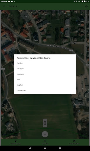
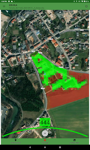
Users can display application maps with the GIS-ELA app.
This makes it possible to apply application maps, e.g.
for site-specific fertilization, even without a terminal on the tractor.
This makes it possible to use the advantages of site-specific management without additional costs.In addition to the visualization of the application map, the location-specific zone values of the shapefile are read out using the internal GPS device and communicated to the user.
This allows the user to focus on applying the information.Since the GPS accuracy can vary from device to device, it is also possible to connect the smartphone or tablet to an external GPS receiver.
After a successful connection with such a receiver, the accuracy of the GIS-ELA App can be further improved.
Social Features
Connect and share with friends and the community.
Gaming Features
Enjoy immersive gaming experience with various game modes.
Fitness Tracking
Track your workouts and monitor your health metrics.
See the GIS-ELA in Action
Get the App Today
Available for Android 8.0 and above